MAPS / THE 25-MILE RADIUS
Regions of the South Bay.
Drawn with love, argued about locally.
One town at a time, a map of how locals actually talk about the place: the region everyone knows, the joke everyone makes, and the border nobody agrees on. It started with El Segundo. The neighbors are next.
Humor maps, not surveys. Borders are approximate and the captions are affectionate jokes about places, not people. Not an official page of any city.
El Segundo
The original. Twelve regions, one refinery.
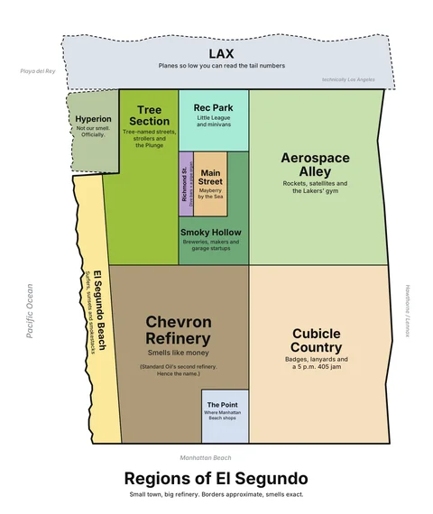
Regions of El Segundo
From “planes so low you can read the tail numbers” to “smells like money,” with a short tour of every region.
Take the tour →
The first drafts
Same pen, same affection. Locals, please correct us.
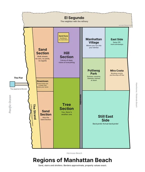
Manhattan Beach DRAFT
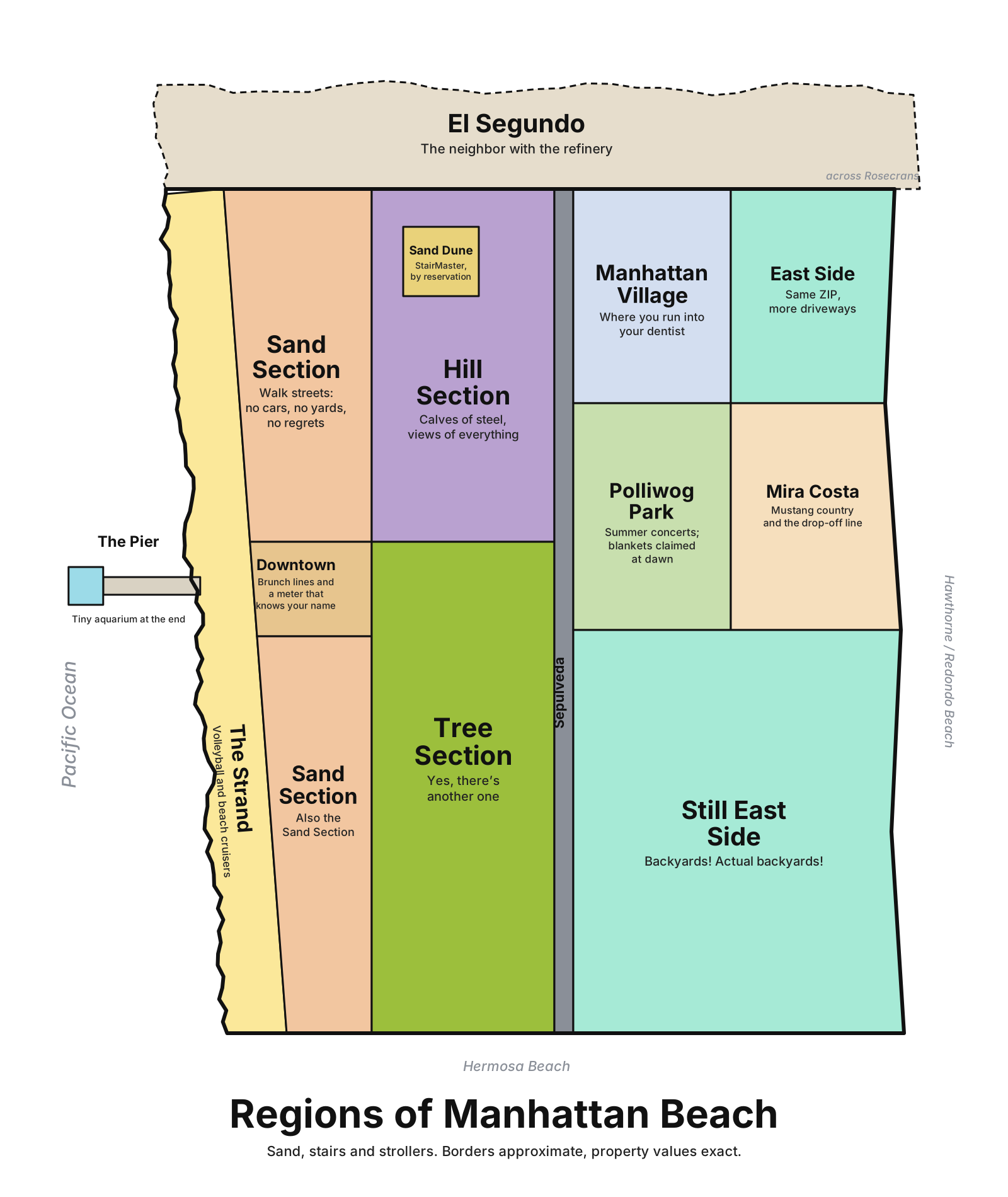
Walk streets with “no cars, no yards, no regrets,” a Hill Section of “calves of steel,” and a Tree Section that wants you to know there’s another one up the road.
Open questions: does Liberty Village get its own region? Is “East Side” fair, or fighting words?
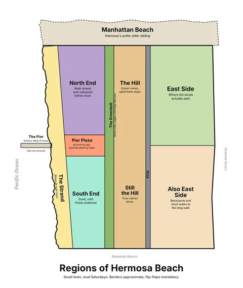
Hermosa Beach DRAFT
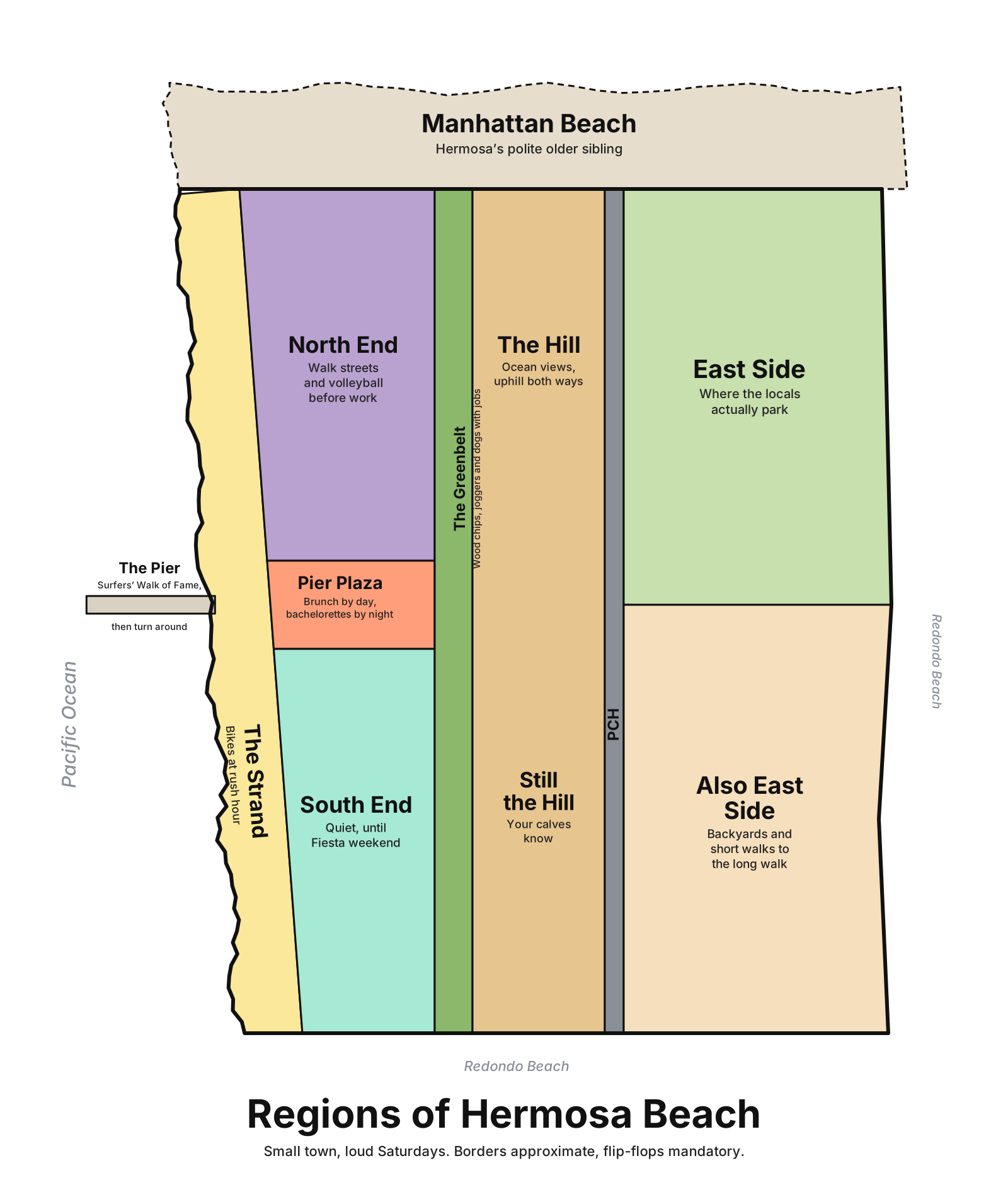
Pier Plaza is “brunch by day, bachelorettes by night,” the Greenbelt is “wood chips, joggers and dogs with jobs,” and the Hill goes uphill both ways.
Open questions: what do locals call the stretch east of PCH? What did we miss on the pier?
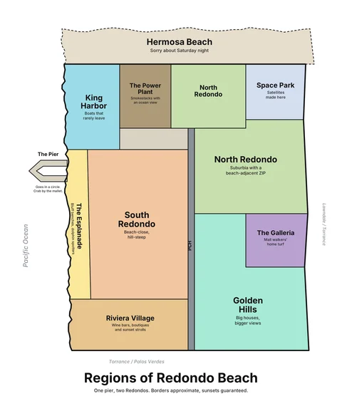
Redondo Beach DRAFT
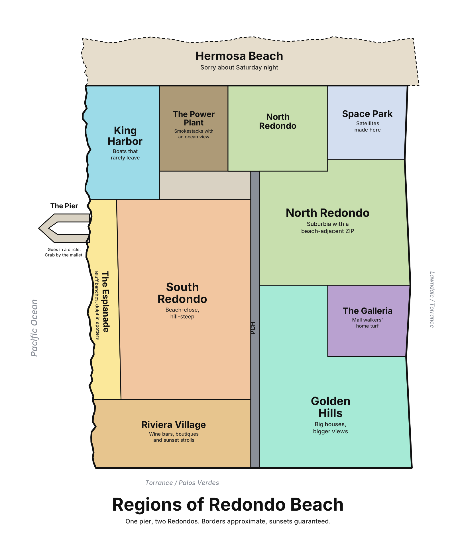
“One pier, two Redondos.” A horseshoe pier that goes in a circle, King Harbor’s “boats that rarely leave,” and a North Redondo that is “suburbia with a beach-adjacent ZIP.”
Open questions: is the North/South split the real line? Where does Riviera Village end?
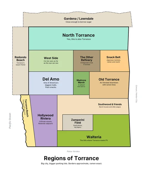
Torrance DRAFT
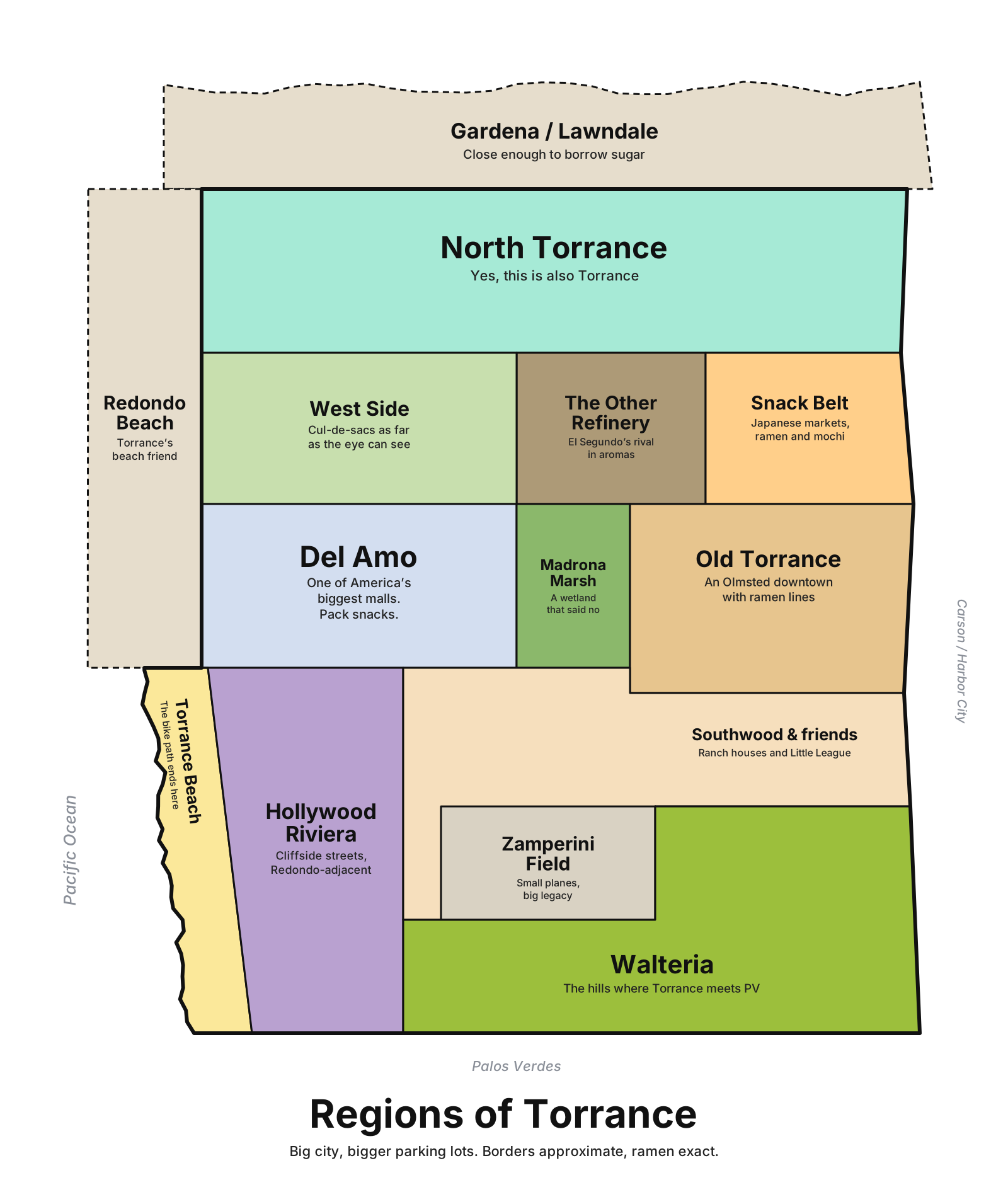
“Big city, bigger parking lots.” Del Amo (“pack snacks”), an Old Torrance downtown with ramen lines, and a refinery that is “El Segundo’s rival in aromas.”
Open questions: Torrance is big. Which neighborhoods did we flatten into “West Side”?
Next in the 25 miles
Roughly in the order we’ll try them
- Playa del Rey and Westchester
- Hawthorne and Lawndale
- Gardena
- Palos Verdes Peninsula
- San Pedro
- Inglewood
- Culver City
- Marina del Rey and Venice
- Santa Monica
- Long Beach
Help draw the next one
Locals know the real borders
- Fix a draft. A better caption, a missing region, a border that’s wrong: send it through Share an update (choose “Correction”) or email mh@pointcast.xyz. Good ideas get credited on the next version, by first name or handle if you like.
- Pitch your town. Live somewhere in the 25 miles? Send five regions and a joke for each. That’s a whole map.
- Want one on your wall? We’re weighing a small run of stickers and prints. If you’d buy one, send a one-line email saying which town. No sign-up, just a count.
Keep it kind and about places, not people. Nothing you send is published without review.