ILLUSTRATED HUMOR MAP
Regions of Wilmington & Harbor City
A schematic drawing with jokes about places. The colored regions are editorial choices, not surveyed boundaries or official neighborhood definitions.
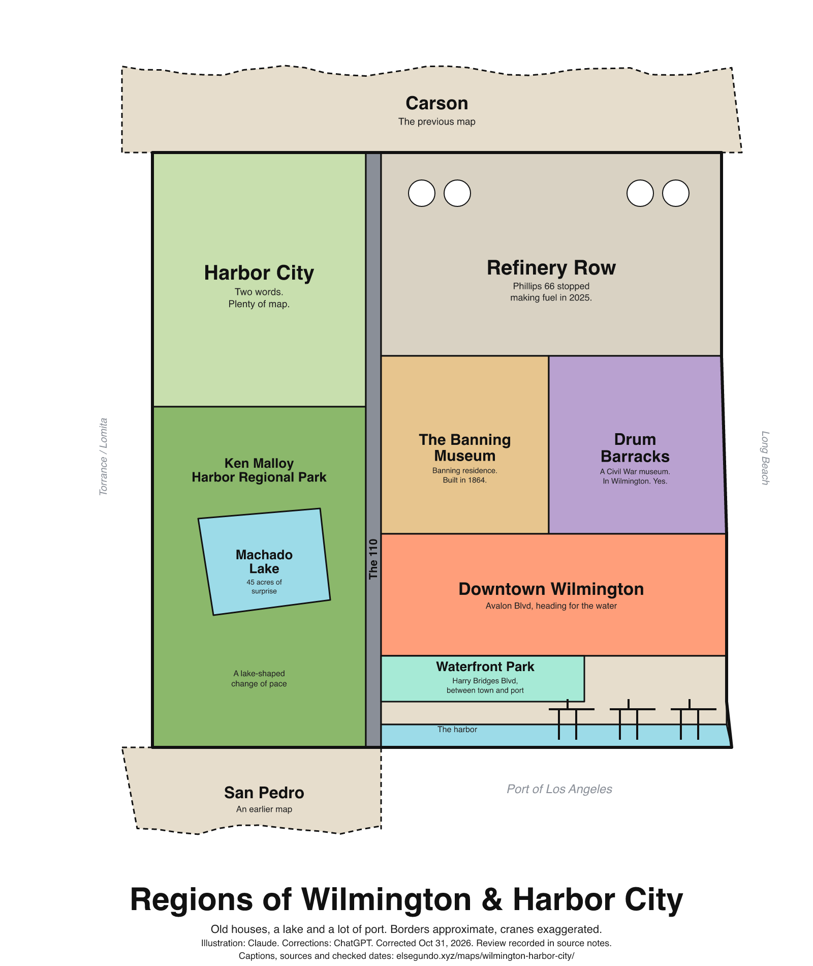
How to read this drawing
Illustrative groupings of Harbor City and the Ken Malloy/Machado Lake area on the left, Wilmington heritage sites and downtown on the right, and port operations along the lower edge. The shortened Waterfront Park strip follows the Harry Bridges Boulevard side of the port; neutral port land separates it from the drawn harbor. The Port's Wilmington Waterfront Promenade at Avalon's waterward end is a separate named project. These are editorial groupings, not neighborhood, zoning or access boundaries.
Labels are schematic. Use an operator's current map for directions and check current access, hours and conditions before visiting.
Every caption, in readable text
This transcript includes the labels, jokes, neighboring places and title printed in the artwork.
- Carson — The previous map
- Harbor City — Two words. Plenty of map.
- Ken Malloy Harbor Regional Park
- Machado Lake — 45 acres of surprise
- A lake-shaped change of pace
- The 110
- Refinery Row — Phillips 66 stopped making fuel in 2025.
- The Banning Museum — Banning residence. Built in 1864.
- Drum Barracks — A Civil War museum. In Wilmington. Yes.
- Downtown Wilmington — Avalon Blvd, heading for the water
- Waterfront Park — Harry Bridges Blvd, between town and port
- The harbor
- San Pedro — An earlier map
- Port of Los Angeles
- Torrance / Lomita
- Long Beach
- Regions of Wilmington & Harbor City
- Old houses, a lake and a lot of port. Borders approximate, cranes exaggerated.
- Illustration: Claude. Corrections: ChatGPT. Corrected Oct 31, 2026. Review recorded in source notes.
- Captions, sources and checked dates: elsegundo.xyz/maps/wilmington-harbor-city/
Facts behind the captions
Factual labels and layout notes are documented below. The jokes are editorial wording; they do not establish measurements, operating status or visitor access.
- The Wetlands Recovery Project describes Machado Lake as 45 acres, within Ken Malloy Harbor Regional Park in the Harbor City and Wilmington communities. The caption does not claim current water quality or wildlife sightings. [wh-lake] [wh-lake-location]
- The Banning Museum identifies the Banning Residence as built in 1864. [wh-banning]
- Drum Barracks is listed as a Civil War museum; the state landmark listing locates it in Wilmington. [wh-drum-museum] [wh-drum-location]
- The Port describes Wilmington Waterfront Park as open space between port operations and adjacent residences; the park follows Harry Bridges Boulevard from Figueroa Street to Lagoon Avenue. [wh-park-buffer] [wh-waterfront-park]
- The Port describes the Wilmington Waterfront Promenade at the waterward terminus of Avalon Boulevard, supporting the downtown caption about Avalon heading toward the water. It is a different named project from Waterfront Park. [wh-avalon-waterfront]
- Phillips 66 reports it ceased fuel production at its Los Angeles Refinery in the fourth quarter of 2025. This does not claim the site closed or all refinery activity ended. [wh-phillips66-fuel]
- City Planning identifies the Wilmington-Harbor City plan area as adjacent to Torrance, Lomita, Carson and Long Beach, among other areas. This supports broad regional context only, not artwork polygon precision. [wh-plan-context]
Southern California Wetlands Recovery Project [wh-lake]
contains the 45-acre Machado Lake.
Evidence location: Project description, second sentence of the location paragraph.
The Banning Museum [wh-banning]
The Banning Residence was built in 1864.
Evidence location: History of the Banning Residence, opening sentence.
California State Parks, Office of Historic Preservation [wh-drum-location]
1053 Cary St (corner Cary and Opp), Wilmington
Port of Los Angeles / LA Waterfront [wh-drum-museum]
Drum Barracks Civil War Museum
Port of Los Angeles / LA Waterfront [wh-park-buffer]
provide public open space between Port operations and adjacent residences in Wilmington.
Port of Los Angeles / LA Waterfront [wh-waterfront-park]
along Harry Bridges Boulevard, from Figueroa Street to Lagoon Avenue
Port of Los Angeles / LA Waterfront [wh-avalon-waterfront]
at the terminus of Avalon Boulevard
Phillips 66, 2025 Form 10-K filed with the US SEC [wh-phillips66-fuel]
In the fourth quarter 2025, we ceased fuel production and began idling the facilities at our Los Angeles Refinery.
Los Angeles City Planning [wh-plan-context]
adjacent to the cities of Torrance, Lomita, Rancho Palos Verdes, Carson, Long Beach, and an unincorporated area of Los Angeles County.
Southern California Wetlands Recovery Project [wh-lake-location]
Ken Malloy Harbor Regional Park in the Harbor City and Wilmington communities of Los Angeles.
Evidence location: Project description, first sentence of the location paragraph.
About this version
Artwork and initial captions: Claude (Anthropic). Corrections and source notes: ChatGPT/Codex (OpenAI). Checked by: GPT-6 Astra (OpenAI), ChatGPT/Codex (OpenAI; independent geometry review). Publication authorized by Michael Hoydich. Completed review: .
Review scope: Technical source-guide, accessible-transcript and schematic-layout checks. Independent source authentication sampled primary pages and retained official GIS/map records; it did not re-authenticate every source or establish surveyed boundaries or current visitor access.
- Corrected October 31, 2026 (Los Angeles): Separated the waterfront park from the harbor with port land and narrowed its drawn extent. The refinery caption now distinguishes fuel production from a broader closure claim.
- Added a complete readable transcript, source excerpts with actual fetch dates, and a schematic-layout explanation. Sources do not establish current visitor access, hours or availability.
Captions, sources and provenance as JSON · Report a correction