ILLUSTRATED HUMOR MAP
Regions of Signal Hill
A schematic drawing with jokes about places. The colored regions are editorial choices, not surveyed boundaries or official neighborhood definitions.
How to read this drawing
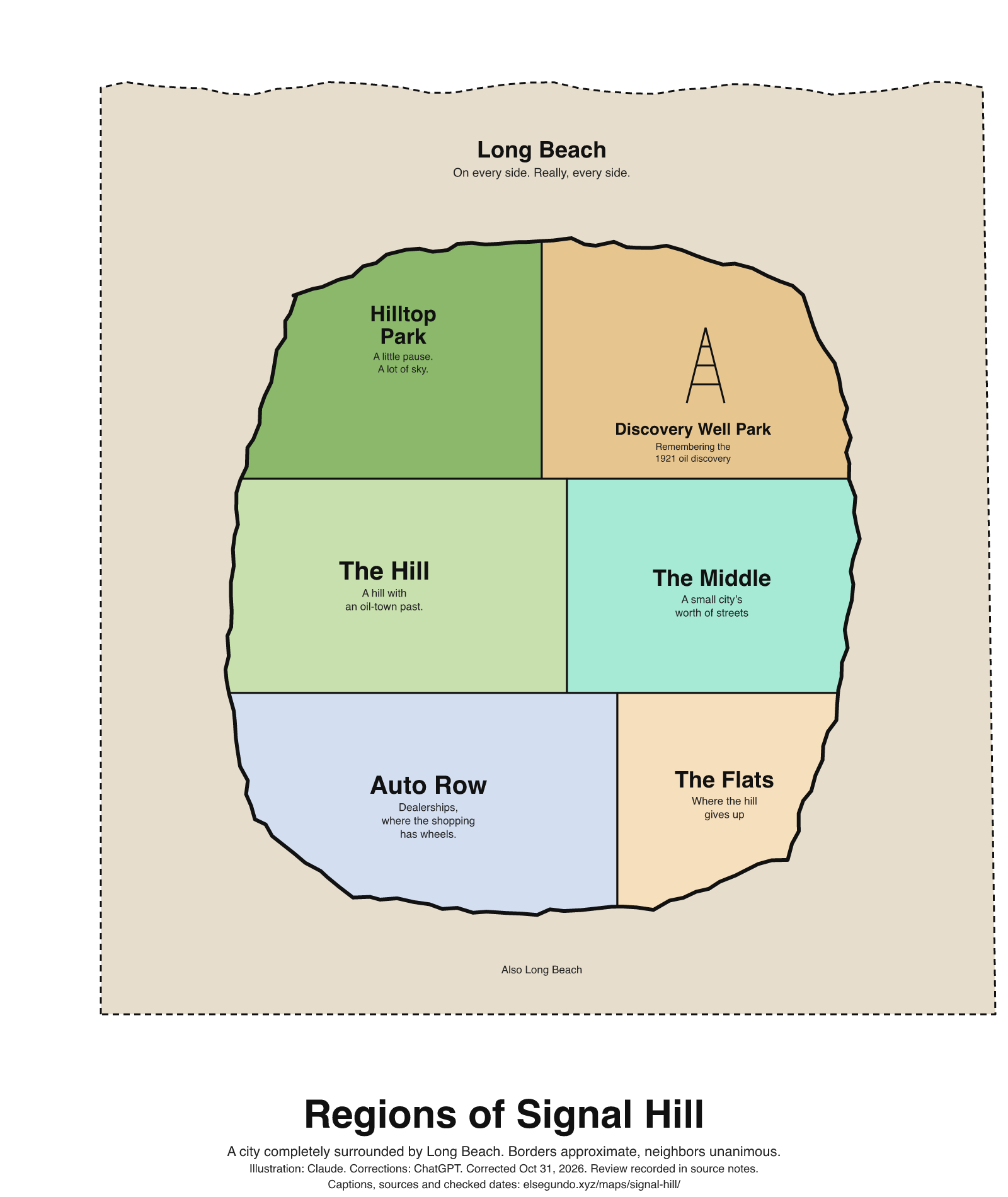
Signal Hill is a separate city surrounded by Long Beach. The hill, flats and middle are editorial regions, not official subdivisions. Hilltop Park and Discovery Well Park are named municipal facilities. Auto Row is an editorial label for the city’s documented auto-center/dealership area, not a formal neighborhood designation.
Labels are schematic. Use an operator's current map for directions and check current access, hours and conditions before visiting.
Every caption, in readable text
This transcript includes the labels, jokes, neighboring places and title printed in the artwork.
- Long Beach — On every side. Really, every side.
- Hilltop Park — A little pause. A lot of sky.
- Discovery Well Park — Remembering the 1921 oil discovery
- The Hill — A hill with an oil-town past.
- The Middle — A small city’s worth of streets
- Auto Row — Dealerships, where the shopping has wheels.
- The Flats — Where the hill gives up
- Also Long Beach
- Regions of Signal Hill
- A city completely surrounded by Long Beach. Borders approximate, neighbors unanimous.
- Illustration: Claude. Corrections: ChatGPT. Corrected Oct 31, 2026. Review recorded in source notes.
- Captions, sources and checked dates: elsegundo.xyz/maps/signal-hill/
Facts behind the captions
Factual labels and layout notes are documented below. The jokes are editorial wording; they do not establish measurements, operating status or visitor access.
- Signal Hill is completely surrounded by Long Beach; the surrounding labels and title refer to that relationship. [sh-surrounded]
- Signal Hill’s municipal history dates its oil discovery to 1921 and describes it as an oil town. No derrick count is asserted. [sh-oil-discovery] [sh-oil-town]
- Hilltop Park and Discovery Well Park are city-listed facilities. The Discovery Well caption commemorates the city’s 1921 discovery rather than making a precise drilling-site claim. [sh-hilltop] [sh-discovery-park] [sh-oil-discovery]
- The city’s auto-center designation covers vehicle sales and service facilities; the dealership caption’s shopping/wheels language is editorial. [sh-auto-center]
City of Signal Hill [sh-surrounded]
completely surrounded by the City of Long Beach
City of Signal Hill [sh-oil-discovery]
discovery of oil in 1921
City of Signal Hill [sh-oil-town]
"oil town,"
City of Signal Hill [sh-hilltop]
Hilltop Park
City of Signal Hill [sh-discovery-park]
Discovery Well Park
City of Signal Hill Municipal Code, published by American Legal Publishing [sh-auto-center]
automobile, truck and motorcycle sales and service facilities which together are known as the Signal Hill auto center
About this version
Artwork and initial captions: Claude (Anthropic). Corrections and source notes: ChatGPT/Codex (OpenAI). Checked by: GPT-6 Astra (OpenAI), ChatGPT/Codex (OpenAI; independent geometry review). Publication authorized by Michael Hoydich. Completed review: .
Review scope: Technical source-guide, accessible-transcript and schematic-layout checks. Independent source authentication sampled primary pages and retained official GIS/map records; it did not re-authenticate every source or establish surveyed boundaries or current visitor access.
- Corrected October 31, 2026 (Los Angeles): Removed unsupported telescope imagery and the derrick count; the remaining oil-history and place notes have dated source evidence.
- Added a complete readable transcript, source excerpts with actual fetch dates, and a schematic-layout explanation. Sources do not establish current visitor access, hours or availability.
Captions, sources and provenance as JSON · Report a correction