ILLUSTRATED HUMOR MAP
Regions of the Palos Verdes Peninsula
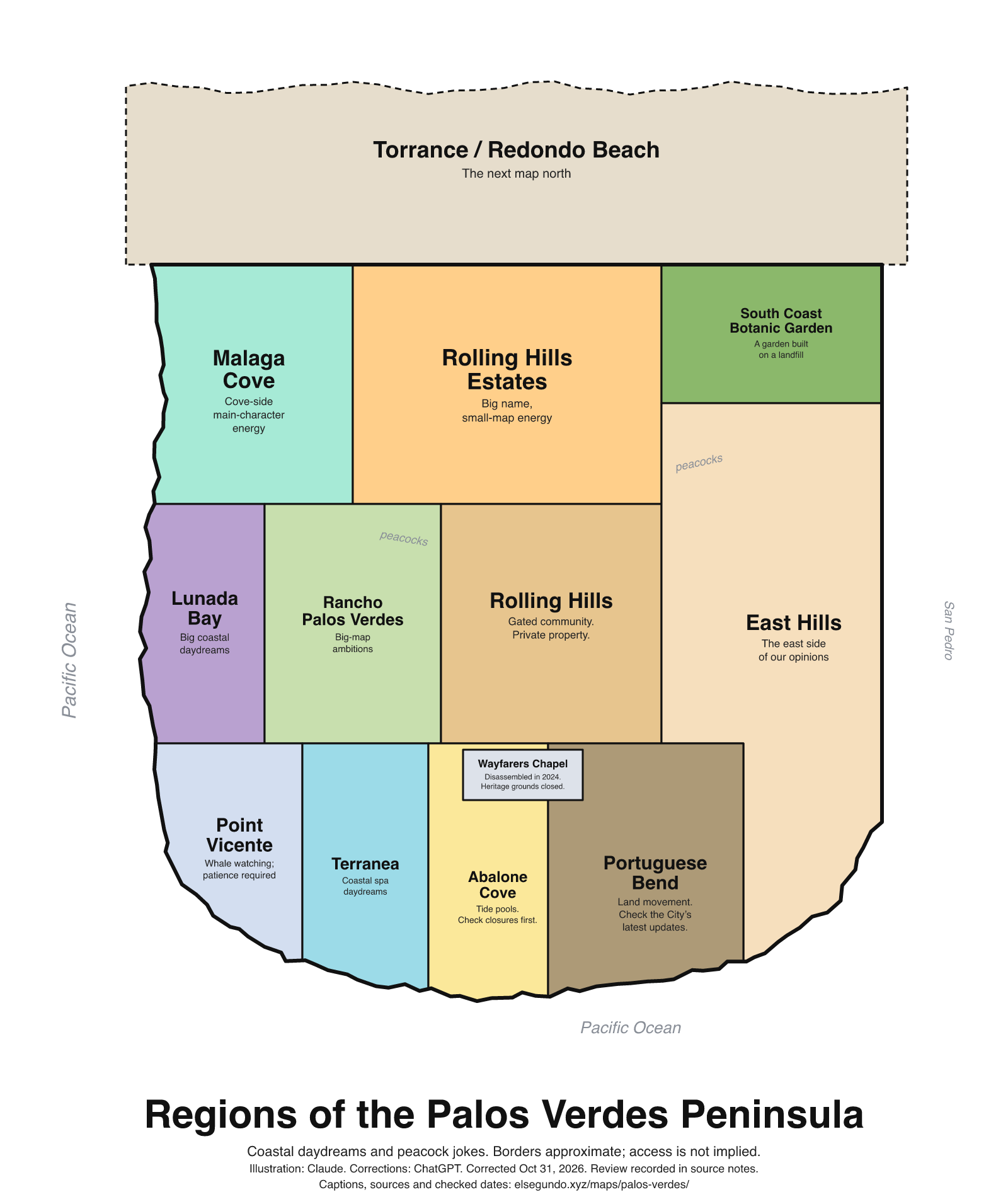
A schematic drawing with jokes about places. The colored regions are editorial choices, not surveyed boundaries or official neighborhood definitions.
How to read this drawing
North-up peninsula schematic with Pacific coastline to the west/south and the San Pedro side to the east. Operator/City locations anchor South Coast Botanic Garden inland, Point Vicente and Terranea on the coastal side, and Wayfarers/Abalone/Portuguese Bend along the southern area. The Wayfarers label is its heritage site, not a future rebuild site. Zones do not promise trail connectivity, beach access or municipal boundary precision.
Labels are schematic. Use an operator's current map for directions and check current access, hours and conditions before visiting.
Every caption, in readable text
This transcript includes the labels, jokes, neighboring places and title printed in the artwork.
- Torrance / Redondo Beach — The next map north
- Malaga Cove — Cove-side main-character energy
- Rolling Hills Estates — Big name, small-map energy
- South Coast Botanic Garden — A garden built on a landfill
- Lunada Bay — Big coastal daydreams
- Rancho Palos Verdes — Big-map ambitions
- Rolling Hills — Gated community. Private property.
- East Hills — The east side of our opinions
- Point Vicente — Whale watching; patience required
- Terranea — Coastal spa daydreams
- Abalone Cove — Tide pools. Check closures first.
- Wayfarers Chapel — Disassembled in 2024. Heritage grounds closed.
- Portuguese Bend — Land movement. Check the City’s latest updates.
- peacocks
- peacocks
- Pacific Ocean
- Pacific Ocean
- San Pedro
- Regions of the Palos Verdes Peninsula
- Coastal daydreams and peacock jokes. Borders approximate; access is not implied.
- Illustration: Claude. Corrections: ChatGPT. Corrected Oct 31, 2026. Review recorded in source notes.
- Captions, sources and checked dates: elsegundo.xyz/maps/palos-verdes/
Facts behind the captions
Factual labels and layout notes are documented below. The jokes are editorial wording; they do not establish measurements, operating status or visitor access.
- South Coast Botanic Garden's site history includes a sanitary landfill before the garden. [pv-garden]
- Rolling Hills is gated. The community association also identifies its property as private; this is not an invitation to its roads or trails. [pv-rolling] [pv-rolling-private]
- Point Vicente is a whale-watching site; the updated caption does not promise a whale sighting or identify a parking lot as the viewing location. [pv-vicente]
- Terranea is a coastal resort with a spa; robes and 'daydreams' are editorial humor, not an included amenity or public-access promise. [pv-terranea]
- The City lists tide pools in Abalone Cove Reserve. Its notice dated July 9, 2024 reports beach-access-trail closures until further notice. Check the City’s current trail alerts before visiting; this historical notice is not a promise of present access. [pv-abalone] [pv-abalone-closure]
- Wayfarers Chapel was disassembled in 2024. Its heritage grounds are closed; its present website explicitly prohibits public access. [pv-wayfarers] [pv-wayfarers-closed]
- Portuguese Bend is an active land-movement area. No current rate, direction of change or 'slower this year' trend is retained in the map. [pv-landmovement]
- The City documents peafowl in Rancho Palos Verdes. Decorative peacock labels are regional humor, not a location tracker or guaranteed wildlife encounter. [pv-peafowl]
South Coast Botanic Garden [pv-garden]
From open pit mine to sanitary landfill to stupendous garden is the extraordinary history of South Coast Botanic Garden.
Rolling Hills Community Association [pv-rolling]
There are three gated entrances to the community.
City of Rancho Palos Verdes [pv-vicente]
This premier whale watch site provides spectacular opportunities to view the annual migration of the Pacific gray whale
Terranea Resort [pv-terranea]
The Pacific at your doorstep, The Spa at Terranea within reach
City of Rancho Palos Verdes [pv-abalone]
tide pools
Evidence location: Features paragraph describing Abalone Cove Reserve.
Wayfarers Chapel [pv-wayfarers]
Wayfarers Chapel was disassembled in 2024 to save it from landslide destruction.
City of Rancho Palos Verdes [pv-landmovement]
The Portuguese Bend Landslide accelerated by an average of 14.8% to .88 inches per week from September to October
City of Rancho Palos Verdes [pv-peafowl]
the peafowl population within the city has grown and expanded its territorial boundaries
Rolling Hills Community Association [pv-rolling-private]
The entire community is on private property
Wayfarers Chapel [pv-wayfarers-closed]
NO PUBLIC ACCESS ALLOWED ON PREMISES
City of Rancho Palos Verdes [pv-abalone-closure]
all beach access trails in the Abalone Cove Reserve are closed to the public until further notice
Evidence location: Closure notice beginning “As of July 9, 2024,” above Features; the date belongs to the notice, not the whole facility page.
About this version
Artwork and initial captions: Claude (Anthropic). Corrections and source notes: ChatGPT/Codex (OpenAI). Checked by: GPT-6 Astra (OpenAI), ChatGPT/Codex (OpenAI; independent geometry review). Publication authorized by Michael Hoydich. Completed review: .
Review scope: Technical source-guide, accessible-transcript and schematic-layout checks. Independent source authentication sampled primary pages and retained official GIS/map records; it did not re-authenticate every source or establish surveyed boundaries or current visitor access.
- Corrected October 31, 2026 (Los Angeles): Removed unsupported movement-rate and rebuilding assertions. Source notes distinguish restricted property, closed grounds and current-access uncertainty.
- Added a complete readable transcript, source excerpts with actual fetch dates, and a schematic-layout explanation. Sources do not establish current visitor access, hours or availability.
Captions, sources and provenance as JSON · Report a correction